Right now: 26,141 lights in U.S. waters, 24,962 of them blinking26,141 lights in U.S. waters, each in its real rhythm
Lights listed in the U.S. Coast Guard Light List (retrieved 2026-10-29). Outage notices are not included. The rest are steady (fixed) lights that don't blink.Real periods, phase reconstructed from a fixed clock
What's that light out there?
Every light in the U.S. Coast Guard Light List, blinking in its real rhythm.
The field guide
397 U.S. lighthouses, 330 major Korean lights and 309 lighthouses in Japan, Norway, Finland and the Netherlands, one page each. Stamp the ones you've visited.
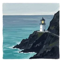
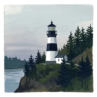
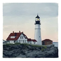
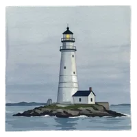
How the lights are drawn
What comes from the lists, and the display rules we chose
The lists give four facts per light: the class (flashing, occulting…), the group, the colour and the period. Those are used as listed. Heights and ranges are the listed numbers, converted exactly (1 nmi = 1,852 m, 1 ft = 0.3048 m) and rounded.
No list publishes how long a flash lasts or when it starts. We draw those with the display rules below, and keep them out of the plain-words line and the score. The phase is a fixed clock plus a per-light offset from its id, so everyone sees the same light in the same state at the same moment, and 4,000 identical "Fl G 4s" buoys don't flash in unison.
A tiny dot stays visible while a light is dark so you can find it. Characteristics we can't read are drawn as a steady 35 % light, and the card shows the text as written.
| Flashing (Fl) | 0.5 s on, 1 s between flashes of a group, 2 s between subgroups (2+1) |
|---|---|
| Long flash (LFl) | 2 s on (the CHS minimum) |
| Quick Q · VQ · UQ | 60 · 120 · 240 per minute, on for 3/10 of each cycle |
| Occulting (Oc) | 1 s dark, 1 s between eclipses, dark ≤ 4/10 of the period |
| Morse (Mo) | dot 0.5 s, dash 1.5 s, gap 0.5 s; no period listed → 8 s display rhythm |
| Fitting | a group longer than 8/10 of the period is scaled down evenly |
| Several colours | drawn white if white is listed, else the first colour; all listed colours are named |
| No colour listed | drawn white, and the card says so |
Real periods; the phase is reconstructed from a fixed clock (real lights don't keep time with each other).
Not for navigation. Use official NOAA charts and USCG Local Notices to Mariners.
Sources
Every number comes from these
- U.S. Coast Guard Light List — U.S. positions, characteristics, ranges, focal heights (U.S. Government work, public domain)
- KHOA light list, data.go.kr 3035490 (KOGL Type 1) — Korean positions, characteristics, heights, ranges, sectors
- Kystverket navigation aids — Lys WFS (Norwegian Coastal Administration, NLOD 2.0) — Norwegian positions, characteristics, ranges, heights; lighthouse stations (Fyrstasjon)
- Väylävirasto aids to navigation — loistot, turvalaitteet, valosektorit WFS (Finnish Transport Infrastructure Agency, CC BY 4.0) — Finnish characteristics, ranges, heights, names and sector colours
- Rijkswaterstaat Vaarwegmarkeringen Nederland (CC0) — Dutch sea and waterway lights: positions, characteristics, colours; lighthouses (vuurtoren)
- OpenStreetMap seamarks (© OpenStreetMap contributors, ODbL) — Japan — volunteer records standing in for the Japan Coast Guard's Umishiru API (no key yet), so many lights are missing
- CHS Chart 1 §P Light characters — What each class means, quick-flash rates
- 33 CFR 62.45 — U.S. quick = 60 per minute, safe water = Morse A
- NIST SP 811 Appendix B.8 — Exact nautical mile, mile and foot
- OpenFreeMap · © OpenStreetMap contributors — Night basemap
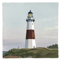
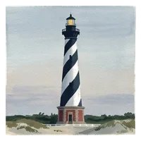
Illustrations: AI-generated (Gemini), edited by plusbeauxjours
Questions
- What does "Fl W 10s" mean?
Fl is a flashing light (dark longer than light), W is white, 10s is the period: one white flash, then darkness, and the cycle repeats every 10 seconds. A number in brackets, as in Fl (2) W 15s, is a group: two flashes every 15 seconds. Every card shows the string as listed and in plain words.
- Are these blinking in sync with the real lights?
The period, grouping and colour are the Light List's. The list doesn't give flash lengths, so we draw them with display lengths (a 0.5 s flash, for example), and the phase comes from a fixed clock. Count along and you get the same rhythm as the real light, but not necessarily at the same instant.
- Why do some lights not blink?
They are fixed lights (F): steady, always on. Roughly 1 in 20 U.S. lights is fixed. Lights whose characteristic we can't read (for example "STROBE") are drawn as a dim steady dot and their card shows the text as written.
- What is nominal range?
The distance in clear weather at which the light can be seen, as printed in the Light List. We convert it exactly (1 nautical mile = 1,852 m, 1 statute mile = 1,609.344 m, NIST SP 811) and round to whole km. Real visibility depends on weather and how high your eyes are.
- Why are lakes and rivers included?
The U.S. Coast Guard Light List also covers the Great Lakes, Lake Champlain and the western rivers, so the map does too. That's why the page says "U.S. waters", not "coasts".
- Why does a buoy say "Mo (A)"?
It flashes Morse code A, short-long: the U.S. safe water mark (33 CFR 62.45). The Light List gives no period for these, so we draw an 8-second display rhythm and the card says "Period not listed — display rhythm".
Sources: KHOA light list (opens in a new tab) · USCG Light List (opens in a new tab) · Kystverket (NLOD 2.0) (opens in a new tab) · Väylävirasto (CC BY 4.0) (opens in a new tab) · Rijkswaterstaat (CC0) (opens in a new tab) · Japan: OpenStreetMap seamarks (ODbL) (opens in a new tab) · OpenFreeMap · © OpenStreetMap (opens in a new tab) · Checked