Phoenix to Seattle: which window seat?
PHX → SEA: LEFT (A) · 19 of 25 flights

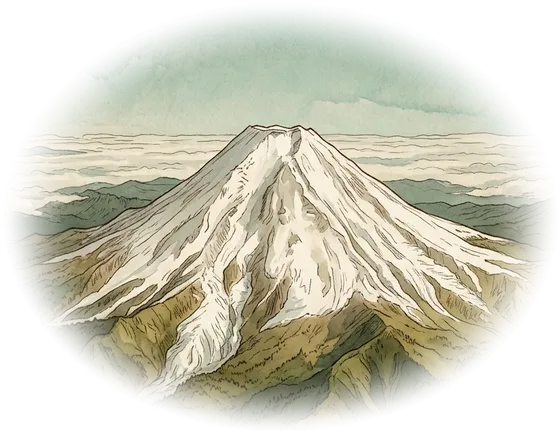
31 km northeast of Mt Rainier · about 18 min before landing
Shortest path (dotted) says left · flights that actually were: 19 of 25
The numbers
The numbers · Mt Rainier
Which side it was
How close the flights passed
- 10–25
- 1925–50
- 550–75
- 75–100
- 100–125
- 125–150
- 150–161
km · near ≤ 80 km · in view ≤ 161 km
When it shows
before landing 13–21min (18min) · Flight time (median) 149min
By month
Seasonal differences will show once more data is in (5 days so far)
Recorded flights (25)
| Date | Flight | Type | Side | km | before landing |
|---|---|---|---|---|---|
| 11-13 | AAL2073 | A319 | left | 31 | 18 |
| 11-13 | AAL2177 | A319 | right | 61 | 18 |
| 11-13 | ASA401 | B738 | left | 31 | 21 |
| 11-13 | ASA603 | B39M | left | 31 | 20 |
| 11-13 | ASA605 | B738 | left | 31 | 16 |
| 11-13 | ASA606 | B739 | left | 31 | 17 |
| 11-13 | ASA645 | B38M | left | 31 | 20 |
| 11-13 | ASA793 | B39M | left | 31 | 18 |
| 11-13 | DAL1502 | B738 | left | 31 | 16 |
| 11-13 | DAL2374 | — | left | 31 | 18 |
| 11-13 | DAL2442 | B738 | left | 31 | 20 |
| 11-13 | DAL2444 | B738 | left | 31 | 19 |
| 11-13 | DAL2449 | B739 | left | 31 | 20 |
| 11-13 | EJA750 | CL35 | right | 61 | 19 |
| 11-13 | ENY4078 | E75L | left | 31 | 21 |
| 11-13 | N454DR | E55P | right | 22 | 15 |
| 11-13 | SWA1693 | B38M | left | 31 | 19 |
| 11-13 | SWA4476 | B38M | right | 61 | 13 |
| 11-13 | SWA4796 | B738 | left | 31 | 15 |
| 11-14 | AAL3120 | B738 | right | 61 | 14 |
| 11-14 | ASA603 | B738 | left | 31 | 17 |
| 11-14 | ASA606 | B738 | right | 61 | 14 |
| 11-14 | ASA611 | B38M | left | 31 | 17 |
| 11-14 | DAL1502 | BCS3 | left | 31 | 17 |
| 11-14 | DAL2449 | B739 | left | 31 | 19 |
Data: 2026-11-10–2026-11-14 (5 days, 15,508 flights in all)
How it is worked out
Window sides counted on 736 routes from 15,508 real flights recorded by adsb.lol over 5 days.
How it is worked out
What counts as a flight
One leg of one aircraft's track whose first and last points are each close to a listed airport (within 50 km and below 12,000 ft). The same aircraft starting the same route again within 30 minutes counts once. Raw tracks are not stored.
Left and right
At the moment the aircraft was closest to the landmark, we look at which side of its direction of travel the landmark was on. It is the path flown, not where the nose pointed.
Viewing distance (our rule)
A flight “passes” a landmark when its closest approach is within 150 km for Mt Fuji, 100 km for Mt Aso, 80 km for Sakurajima and 25 km for Seoul at night (Jamsil). Within 80 km, 50 km, 40 km and 12 km it counts as “near” and the painting is drawn large. Closer than 5 km is under the aircraft: neither side. This is a plusbeauxjours rule, not a measured visibility, and weather and cloud are not modelled.
Right after takeoff, right before landing
A closest approach within 30 seconds of the first or last point of the leg is not a pass.
When we name a side
A side needs at least 60% of the passes; below that the answer is “it varies”. “Of N flights” counts every recorded flight on the route, including those that did not pass. If fewer than 25% of flights pass, we say “rarely”, and routes with fewer than 10 flights are marked “early sample”.
Distance, direction, minutes
Distance is the smallest to the largest among flights on that side. Direction is where the aircraft was as seen from the landmark (“south” means it passed south of it). Minutes are counted after takeoff or before landing (median).
Which landmark comes first
The mountain passed by the most flights on that route. Seoul at night comes first only when no mountain is passed and at least half the flights pass it; otherwise it is a chip you can pick.
Light or dark
We take your departure time plus the median minutes and compute the sun's altitude at the landmark with the NOAA equations. A mountain is lit when the sun is above the horizon (0° or more); Seoul's lights are on when the sun is below −6° (the end of civil twilight). Skylines such as Manhattan or Hong Kong count as visible day and night. Dates and times are the departure airport's local clock (daylight saving included).
World routes (added 16 Nov)
Mountains in Europe, the Americas and Southeast Asia get a distance from their prominence: 60 km plus 25 km per km of prominence, at most 180 km (Mont Blanc 177 km, Mt Rainier 161 km). Lakes and canyons use about half their length; cities such as Manhattan, the Las Vegas Strip, the Golden Gate or Victoria Harbour count only below 10,000 ft (takeoff and approach). Where a track has a gap longer than 10 minutes (over oceans or Siberia) we never guess the closest approach.
Aurora
Not a fixed landmark. For every route and month we count the minutes flown with the sun below −12° (nautical dark) at the aircraft and a geomagnetic latitude of 55° or more (centred-dipole model, IGRF-14 epoch 2025 pole at 80.8°N 72.7°W). The aurora sits on the poleward side, so we name that window (usually left flying east, right flying west). Coverage gaps are filled along the great circle. It is a possibility, not a forecast: for tonight, see the NOAA SWPC 30-minute aurora forecast.
The dotted line (shortest path)
The great-circle route between the two airports. It is the line most “which side” calculators use, so we print which side it would give and how many recorded flights were actually on that side.
Art
Illustration: AI-generated (Gemini), edited by plusbeauxjours. The window light, where the landmark sits, the route on the chart and every word are placed by code from the data.
Sources · Flight data: adsb.lol (ODbL 1.0)
Flight data: adsb.lol (ODbL 1.0) · Download the per-route statistics (stats.json, ODbL 1.0)
- adsb.lol · globe_history daily releases (readsb traces), ODbL 1.0 checked 2026-11-15
The source of every track. Daily releases are fetched and recomputed per route. - adsb.lol · globe_history_2026 releases checked 2026-11-15
The per-day release files. - Open Data Commons · Open Database License (ODbL) v1.0 checked 2026-11-15
The licence of the track data and of the stats.json this page publishes. - adsb.lol · API licence statement and rate limits checked 2026-11-15
Read for the licence statement. This page never calls the API. - 国土地理院 (GSI) · 日本の主な山岳標高 2026-03-31版: 富士山 剣ヶ峯 3,776 m · 阿蘇山 中岳 1,506 m · 桜島 御岳 1,117 m checked 2026-11-15
Position and height of Mt Fuji, Mt Aso and Sakurajima. - 국가기록원 · 한라산 1,947.269 m checked 2026-11-15
Hallasan's height (position from OpenStreetMap). It appears by itself once Jeju tracks are recorded. - 비즈워치 · 롯데월드타워 555 m, 서울시 사용승인 2017-02-09 checked 2026-11-15
Height of the Jamsil tower, the reference point for Seoul at night (press report; position from OpenStreetMap). - OurAirports · Airports and runways (public domain) checked 2026-11-15
Airport positions, used only to match a track's two ends. - 国立天文台 (NAOJ) · 暦計算室 東京 2026年12月の日の出入り: 12/20 日の入り 16:31 checked 2026-11-15
The check value for our sun calculation (NOAA equations), which also gives 16:31. - Natural Earth · 1:50m land (public domain) checked 2026-11-15
The coastline under the painted chart.
Good to know
These are statistics of flights that were actually recorded. Routes change every day with weather and air traffic control, and clouds can hide everything. Check your seat with the airline.
Row letter A is the left window on almost every airline. The right-window letter (F, H, J or K) depends on the aircraft, so we only say “F, K …”. Check the airline's seat map.
The viewing distances are a plusbeauxjours rule, not a measured visibility.
Only aircraft heard by adsb.lol receivers are included. Flights whose first point near the airport is missing are dropped, so the counts are lower than the real schedule.
Related tools
- Which plane is flying over me right now? (plane-overhead)
- Landing at Incheon late at night (icn-night)
- Japan tax-free shopping calculator (japan-tax-free)
- All plusbeauxjours tools
- 한국어: 어느 쪽 창가에 앉아야 후지산이 보일까?
- 日本語: 富士山が見えるのはどっちの窓側?
Routes with the most flights: Fukuoka→Tokyo Haneda · Tokyo Haneda→Fukuoka · Tokyo Haneda→Sapporo · Sapporo→Tokyo Haneda · Tokyo Narita→Seoul Incheon · Osaka Kansai→Seoul Incheon · Seoul Incheon→Osaka Kansai · Seoul Incheon→Tokyo Narita · Tokyo Haneda→Hiroshima · Osaka Itami→Tokyo Haneda · Tokyo Haneda→Osaka Itami · Seoul Gimpo→Busan · Busan→Seoul Gimpo · Fukuoka→Seoul Incheon · Seoul Incheon→Fukuoka · Kagoshima→Tokyo Haneda · Kitakyushu→Tokyo Haneda · Tokyo Narita→Sapporo · Tokyo Haneda→Kagoshima · Sapporo→Tokyo Narita · Tokyo Haneda→Kitakyushu · Kumamoto→Tokyo Haneda · Tokyo Haneda→Kumamoto · Osaka Kansai→Osaka Itami
Questions
Is Seoul Gimpo to Tokyo Haneda really the left side?
On the recorded flights, yes: GMP → HND: LEFT (A) · 52 of 52 flights. 66–78 km south of Mt Fuji · about 26 min before landing.
Which side for Incheon to Narita?
ICN → NRT: no mountain in view · 174 flights. Every recorded flight stayed outside our viewing distance for Mt Fuji (150 km). The closest: Mt Fuji, 151 km away.
Why do other sites say the right side?
Many calculators draw the straight shortest path between the two airports. Real flights follow set airways, so the answer can differ. For Gimpo to Haneda: Shortest path (dotted) says right · flights that actually were: 0 of 52.
How many minutes into the flight?
It depends on the route. Gimpo to Haneda: 66–78 km south of Mt Fuji · about 26 min before landing. Pick your route to see its own timing.
Can I see it at night or on a cloudy day?
No. A mountain only shows in daylight. Enter your date and departure time and we check the light. Cloud and weather are not modelled.
Is seat A always the left window?
Usually. The letter of the right window depends on the aircraft (F, H, J or K). Check the airline's seat map.
Where does the data come from?
Real recorded tracks published by adsb.lol (ODbL 1.0), fetched and recomputed every day. Right now: 5 days from 2026-11-10 to 2026-11-14, 15,508 flights.
What about the flight back?
Press the ⇄ button between the two airports. HND → GMP: LEFT (A) · 56 of 56 flights.