What's on the opposite side of the world from Philadelphia?

Australia 1,105 km
Opposite Philadelphia: the Indian Ocean · 1,105 km to Australia
0.48% of the US has land opposite · 43rd of 57 countries
86.9% of the world's land has sea on the other side
| How to get there | Distance | Time |
|---|---|---|
| Straight downThe time to fall, with no air, no friction and an evenly dense Earth. With the Earth's real density it comes to 38 minutes (Klotz, 2015). No such tunnel exists. | 12,742 km | 42 min |
| Along the surfaceOn a sphere, the exact opposite point is half a turn away in every direction. | 20,015 km | The same whichever way you set off |
Move the pin on the map
One more place
A place to compareNearest town Busselton, 1,171 km · Not China: 0.5% of the US has land underneath
More in pictures
As a table
| Country | Land with land opposite |
|---|---|
| Malaysia | 100% |
| Fiji | 100% |
| Philippines | 100% |
| Taiwan | 100% |
| New Caledonia | 99.69% |
| Chile | 94.9% |
| Argentina | 86.22% |
| Cambodia | 86% |
| Greenland | 82.92% |
| Ecuador | 67.94% |
| Indonesia | 66.96% |
| New Zealand | 59.94% |
| Vietnam | 50.98% |
| Peru | 38.13% |
| Antarctica | 31.84% |
| Guyana | 30.25% |
| Colombia | 29.12% |
| Spain | 27.87% |
| People's Republic of China | 26.64% |
| Mongolia | 26.48% |
| Venezuela | 23.52% |
| Laos | 18.57% |
| Portugal | 17.26% |
| Canada | 15.32% |
| Brazil | 11.27% |
| Western Sahara | 8.92% |
| Suriname | 8.56% |
| Paraguay | 8.3% |
| Thailand | 6.54% |
| Bolivia | 4.71% |
| Russia | 4.7% |
| Solomon Islands | 3.45% |
| Botswana | 2.82% |
| Norway | 2.73% |
| Senegal | 2.22% |
| South Korea | 2.02% |
| Mauritania | 1.8% |
| France | 1.62% |
| Mali | 1.52% |
| Japan | 0.87% |
| Morocco | 0.57% |
| Uruguay | 0.54% |
| United States of America | 0.48% |
| Guinea | 0.38% |
| Niger | 0.31% |
| Sudan | 0.1% |
| Ethiopia | 0.09% |
| Namibia | 0.07% |
| Algeria | 0.03% |
| Democratic Republic of the Congo | 0.02% |
| Eritrea | 0.02% |
| India | 0.01% |
| Central African Republic | 0.01% |
| Saudi Arabia | 0.01% |
| Chad | 0.01% |
| Ghana | 0.01% |
| Egypt | 0.01% |
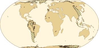
13.1% of the world's land · 3.8% of the Earth's surface
As a table
| World land | 13.09% |
|---|---|
| Earth's surface | 3.77% |
 South Korea 2.0%
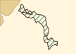 Japan 0.9%
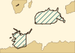 USA 0.5%
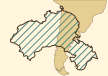 China 26.6%
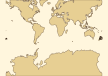 Spain 27.9%
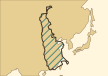 Argentina 86.2%
As a table
| Country | Land with land opposite |
|---|---|
| South Korea | 2.01% |
| Japan | 0.9% |
| USA | 0.48% |
| China | 26.64% |
| Spain | 27.87% |
| Argentina | 86.22% |
How it is worked out
The opposite point
Flip the sign of the latitude and add or subtract 180° of longitude.
Sea, land or lake
Inside a Natural Earth 1:10m lake it is a lake; inside a country or a minor island it is land; otherwise it is sea.
The nearest edge
Distance to the nearest point on any country or island outline, measured on a sphere of radius 6,371.0088 km (within about 0.5%). Under 5 km we mark the answer as near an edge. That threshold is our own rule.
Clock, day or night, season
On land, the time zone of the nearest town in the same country; at sea, time by longitude. Day or night uses NOAA's solar position equations (day at −0.833° or higher). Seasons are NOAA NCEI's meteorological seasons; none inside the tropics.
Why the numbers differ
“Dig to China” does not hold from the US: the opposite of every US city in our list is ocean, and the 0.5% of US land with land underneath faces Antarctica, Botswana and the French Southern Lands.
What is not modelled
The Earth is treated as a sphere, not an ellipsoid. Map lines are generalised at 1:10m; borders and names follow Natural Earth. The rock layers in the picture are a mood, not geology.
Sources
- 날씨: MET Norway (CC BY 4.0)
- 파도: PacIOOS WaveWatch III (University of Hawaii, NOAA / NCEP)
- 지도·국경: Made with Natural Earth
- City data: GeoNames (CC BY 4.0)
- Illustration: AI-generated (Gemini), edited by plusbeauxjours
- Natural Earth · 1:10m Admin 0 – Countries checked 2026-11-17
Land or sea, the country underneath, borders, distance to the coast, country names - Natural Earth · 1:10m Minor Islands checked 2026-11-17
Islets the country layer leaves out - Natural Earth · 1:10m Lakes checked 2026-11-17
Whether the opposite point is on a lake - Natural Earth · 1:10m Marine Areas checked 2026-11-17
The name of the sea underneath - Natural Earth · 1:10m Populated Places checked 2026-11-17
Nearest town, its time zone, the 602 world cities - 국립중앙의료원 (공공데이터포털) · 전국 병·의원 및 약국 좌표로 만든 시군구 중심점 272곳 checked 2026-10-27
Centres of the 272 Korean districts (where people live, not polygon centroids) - GeoNames · cities15000 checked 2026-10-29
City search (coordinates to 2 decimals, about 1 km) - MET Norway · Locationforecast 2.0 checked 2026-11-17
Temperature, cloud, wind, precipitation (forecast model values) - PacIOOS (University of Hawaii) · WaveWatch III Global Wave Model checked 2026-11-17
Wave height and period (model values, within ±77.5° latitude) - NASA NSSDCA · Earth Fact Sheet checked 2026-11-17
Earth's radius and gravity → 12,742 km, 42 minutes - A. R. Klotz, American Journal of Physics 83, 231 (2015) · The gravity tunnel in a non-uniform Earth checked 2026-11-17
38 minutes with the Earth's real density - NOAA NCEI · Meteorological Versus Astronomical Seasons checked 2026-11-17
Seasons (March to May is spring; six months shifted in the south) - NOAA GML · Solar Calculation Details checked 2026-11-17
Sun altitude → day or night - 한국어 위키백과 · 대척점 (2025-04-05 판, 39060164) checked 2026-11-17
The revision that gives the longitude opposite Seoul as 43°01′19″ W
Last updated 2026-11-17
Good to know
Distances are approximate and not for navigation or surveying. Within 5 km of a coast or border the answer can change with a finer map.
Weather and waves are model values, not observations. Do not use them for boating, fishing, surfing or flying decisions.
Your location stays on your device. To fetch the weather we send only the opposite point, rounded to 0.1°. Not affiliated with any agency.
Related tools
- Your hometown from space on the day you were born
- Which side of the plane to sit on
- Which side of the train
- When it gets dark today
- Where your water comes from (water-journey)
- Which plane is flying over me
- All plusbeauxjours tools
- 지구 반대편, 지금 거긴
- 地球の真裏、いまそこは
Other places: New York · Los Angeles · Chicago · Miami · Philadelphia · Dallas · Atlanta · Boston · Houston · Washington, D.C. · Detroit · Phoenix · San Francisco · Seattle · Irvine · San Diego · Minneapolis · Tampa · Denver · Baltimore · St. Louis · Fort Lauderdale · Long Beach · Cleveland · Portland · Pittsburgh · Las Vegas · San Bernardino · San Jose · Cincinnati · Shanghai · Beijing · Manila · Jakarta · Guangzhou · Lima · Shenzhen · Wuhan · Hong Kong · Tianjin · Taipei · Santiago · Madrid · Ho Chi Minh City · Singapore · Dongguan · Xian · New Taipei · Nanjing · Zhangzhou
Questions
If I dig straight down from the US, do I come out in China?
No. All 50 of the 50 US cities in our list come out in the ocean, most of them in the Indian Ocean. Only 0.5% of US land has land on the other side.
How much of the world has land on the other side?
13.1% of the land, which is 3.8% of the Earth's surface. Of the 602 cities we computed (capitals and cities of a million or more), 482 have sea underneath.
What time is it on the other side?
By longitude it is exactly 12 hours apart. On land we show that country's clock time; at sea we show the time by longitude. Seasons are opposite too: autumn here is spring there.
Could you really fall through the Earth?
No such tunnel exists. On paper the diameter is 12,742 km, and with no air or friction the fall takes about 42 minutes. A paper using the Earth's real density gets 38 minutes.
Where do the weather and waves come from?
Temperature, cloud and wind are forecast-model values from MET Norway; waves are from PacIOOS's global WaveWatch III model. They are model values, not observations.